In the face of climate change impacts – specifically sea level rise – we need to be strategic in adapting. PEP developed the Critical Lands Protection Strategy (CLPS) in order to inform land acquisition priorities and reach land protection goals.
Did you know that protecting land can increase resiliency and improve water quality?
Protecting land not only provides safe haven for wildlife species, but it also provides:
- Wetland habitats the room to migrate inland as sea level rises
- ‘Living shoreline’ project opportunities that strengthen our shores from storm surges while also preserving open access to our bays
- Protection of our groundwater from unwanted pollution and the ability to better handle flooding as water tables rise
If we can prioritize the parcels of land that will provide the greatest potential to protecting and preserving the health of the estuary, then we can move forward in making informed decisions about our land – building a cleaner and more resilient future.
To make this easy, we have developed The Critical Lands Protection Strategy Criteria and Ranking Tool
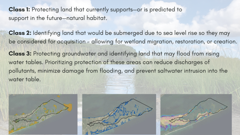
This tool assigns a priority score to individual parcels of land based on how they meet or do not meet our carefully selected criteria. We ask questions like – Is this parcel of land located in an area that will become inundated under future sea-level rise projections? Does this parcel of land contain or will contain freshwater or tidal wetlands? We have organized criteria like these into three groupings with the goals of:

This information has been transformed into interactive maps! Municipalities, land stewards, and decision makers alike can use this tool to help decide which lands to acquire and evaluate which climate adaptation strategy is appropriate. This tool will help us make land management decisions that will matter for habitat and water quality protection, now and in the future.The Critical Lands Protection Strategy Criteria and Ranking Tool was designed to help decision makers not only decide which lands to acquire, but also evaluate which adaptation strategy is appropriate by prioritizing land protection focused on current and projected areas that are important for habitat and water quality protection. The tool can be used to evaluate climate adaptation strategies.
Explore this interactive story map to learn more about Peconic Estuary Critical Lands Protection Strategy (CLPS) which was updated in 2019. PEP hosted a virtual workshop to guide you in using our interactive story map and ranking tool.
MAP LINKS:
